
Topo
Auto-topographic data collection
Overview
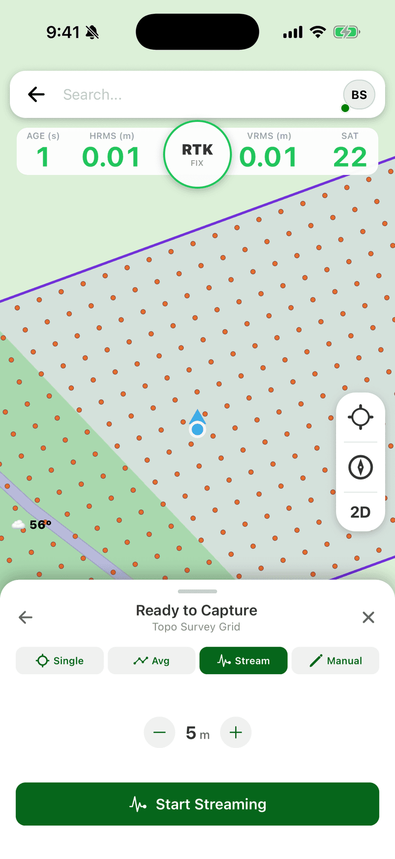
The Topo workflow provides auto-topographic data collection. Instead of manually tapping to collect each point, Topo mode automatically captures points at set time or distance intervals as you walk your site. Supports Eos Positioning Systems' tilt compensation and Smart Handle for hands-free operation.
Perfect for terrain modeling, surface mapping, and any application where you need dense, evenly-spaced point coverage. Includes cross track navigation for following survey lines.
Key Features
Time-Based Capture
Automatically collect a point every X seconds. Ideal for slow, methodical surveys where you need consistent temporal spacing.
Distance-Based Capture
Collect a point every X meters/feet traveled. Perfect for creating evenly-spaced point grids regardless of walking speed.
Eos Tilt Compensation
Eos Positioning Systems' tilt compensation and Smart Handle support for accurate data capture without leveling the pole.
Cross Track Navigation
Follow survey lines with cross track navigation guidance. Stay on course for systematic site coverage and terrain modeling.
How It Works
- 01
Configure Topo Settings
Choose time-based or distance-based capture and set your interval. For example, collect a point every 5 seconds or every 2 meters.
- 02
Start Topo Session
Begin your topo session. FastXY will start automatically collecting points based on your configured interval.
- 03
Walk Your Site
Traverse your project area. Points are captured hands-free as you walk. Focus on coverage patterns, not button presses.
- 04
Review & Export
End your session and review collected points. Export to your preferred format for terrain modeling or GIS analysis.
Common Use Cases
- Site Grading Surveys
Capture existing ground elevations for cut/fill calculations
- Terrain Modeling
Build DTM/DEM surfaces from dense point clouds
- Drainage Analysis
Map terrain for stormwater and drainage planning
- As-Built Verification
Verify completed grading matches design specifications
Try Topo Free for 30 Days
Topo is a premium feature. Start your free trial to access Topo and all other premium workflows.