
Static Capture
RINEX data collection & OPUS submission for static post-processing
Overview
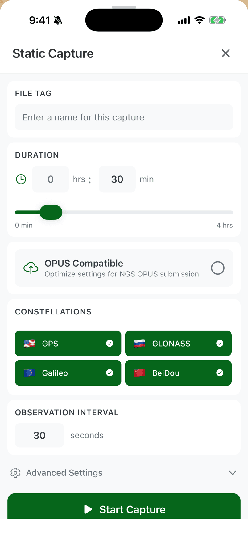
The Static workflow provides RINEX data collection and OPUS submission directly from your mobile device for static post-processing. Record raw GNSS observations and submit to OPUS without needing a desktop computer.
Perfect for establishing control points, monitoring applications, or any situation where you need the highest possible accuracy through post-processing rather than real-time corrections.
Key Features
Configurable Duration
Set observation duration from minutes to hours. Longer observations yield better results for post-processing.
RINEX Data Collection
Collect observations in standard RINEX format compatible with all major post-processing services and software.
OPUS Submission
Submit RINEX data to OPUS directly from your mobile device for static post-processing. No desktop computer required.
Multi-Constellation
Record observations from GPS, GLONASS, Galileo, and BeiDou for optimal geometry and accuracy.
Progress Tracking
Real-time display of observation progress, satellite count, and data quality indicators during collection.
How It Works
- 01
Set Up Your Position
Place your GNSS receiver on a stable mount over the point you want to determine. Ensure clear sky visibility for best results.
- 02
Configure & Start
Set your desired observation duration. Longer sessions yield better accuracy. Start recording and let FastXY collect the data.
- 03
Export RINEX
When complete, export your observations as a RINEX file. Include antenna height and other metadata for accurate processing.
- 04
Submit to OPUS
Submit your RINEX data to OPUS directly from your mobile device for static post-processing, or export for use with other services like CSRS-PPP or AUSPOS.
Common Use Cases
- Control Point Establishment
Establish survey control points with centimeter-level accuracy through post-processing
- Geodetic Monitoring
Monitor structures, slopes, or ground movement over time with repeated observations
- Remote Area Positioning
Get high accuracy in areas without RTK correction coverage using post-processing
- Base Station Setup
Accurately position a temporary base station for local RTK operations
- GCP Collection
Collect ground control points for drone mapping and photogrammetry projects
Try Static Capture Free for 30 Days
Static Capture is a premium feature. Start your free trial to access Static Capture and all other premium workflows.