Next-GenerationField Data Collection
High-accuracy geospatial data collection — RTK centimeter-accurate or submeter accuracy for GIS, Engineering and Construction
Free forever, no account required · Premium free for 30 days — no card

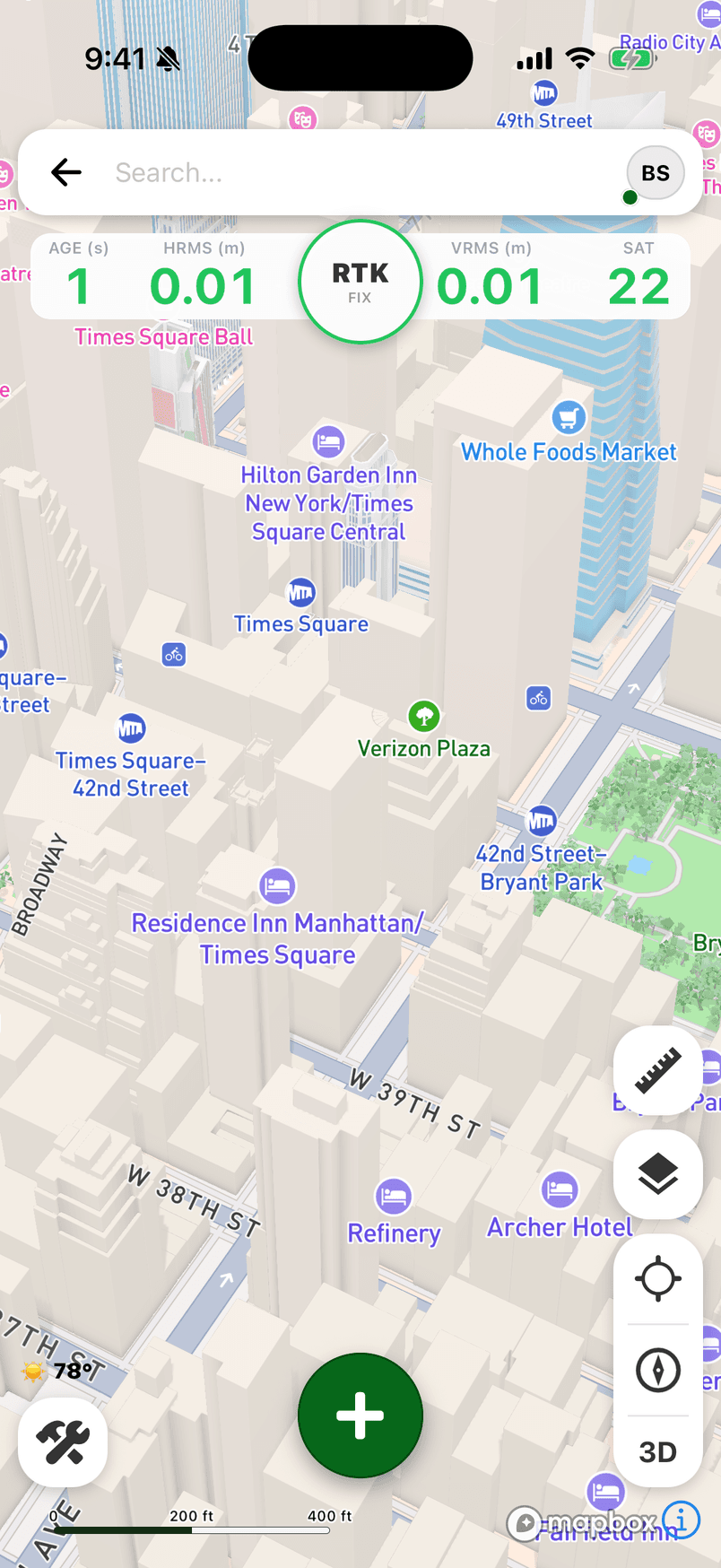
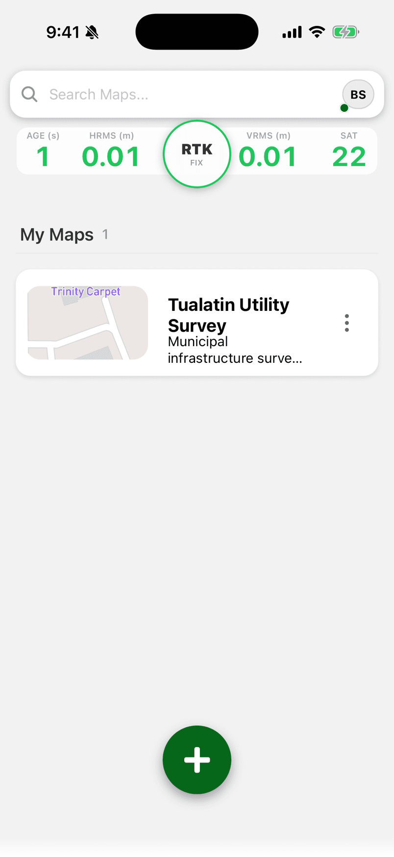
Live FastXY capture · Tualatin, OR · RTK Fixed
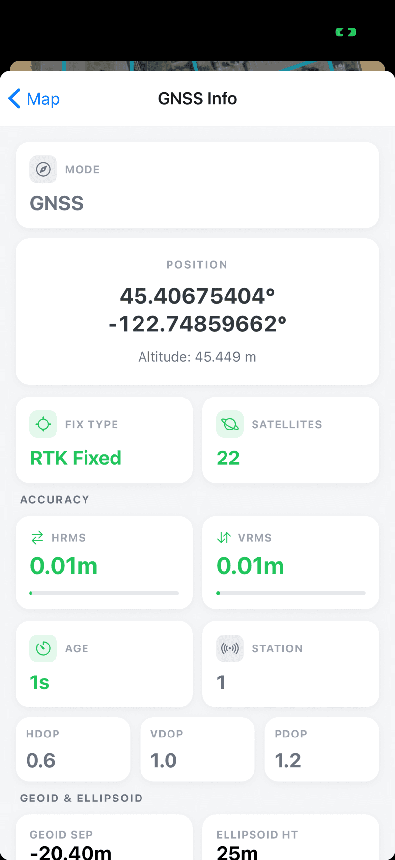
High-accuracy GNSS data displayed in real-time
RTK GNSS performance shown live in the app
Values depend on your receiver and correction source.
Set accuracy limits, required or recommended
Set your quality bar — the Fix type, the accuracy, the satellite count you need. FastXY monitors every shot and reports the moment a shot falls short. Undesirable points never get saved, so clean data comes back from the field — no matter who collected it.
- You set the bar: None, Warn, or Required
- Required means mandatory
- Live green/yellow/red for instant user feedback
GIS, Construction, Engineering workflows
From real-time field collection to post-processed static sessions — all in one app.
CollectFree
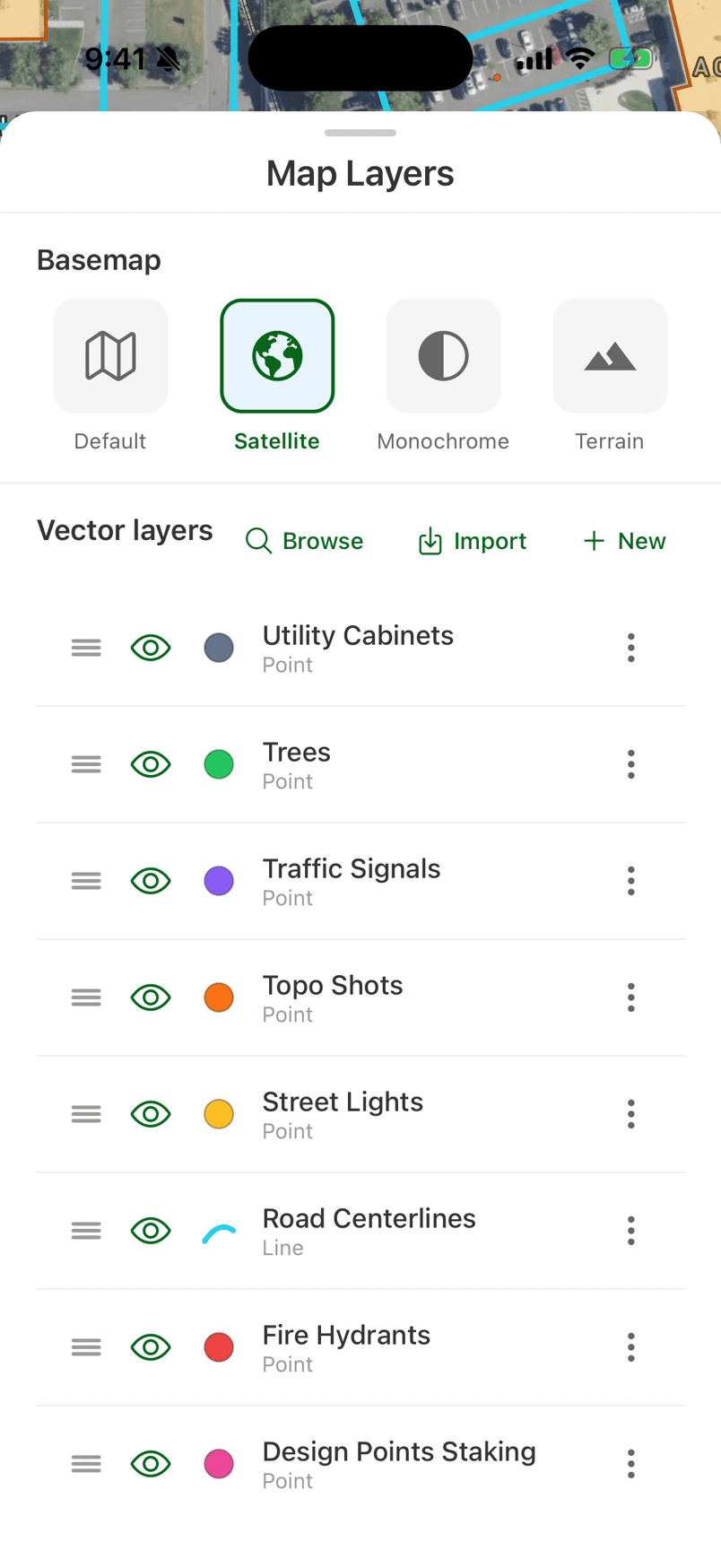
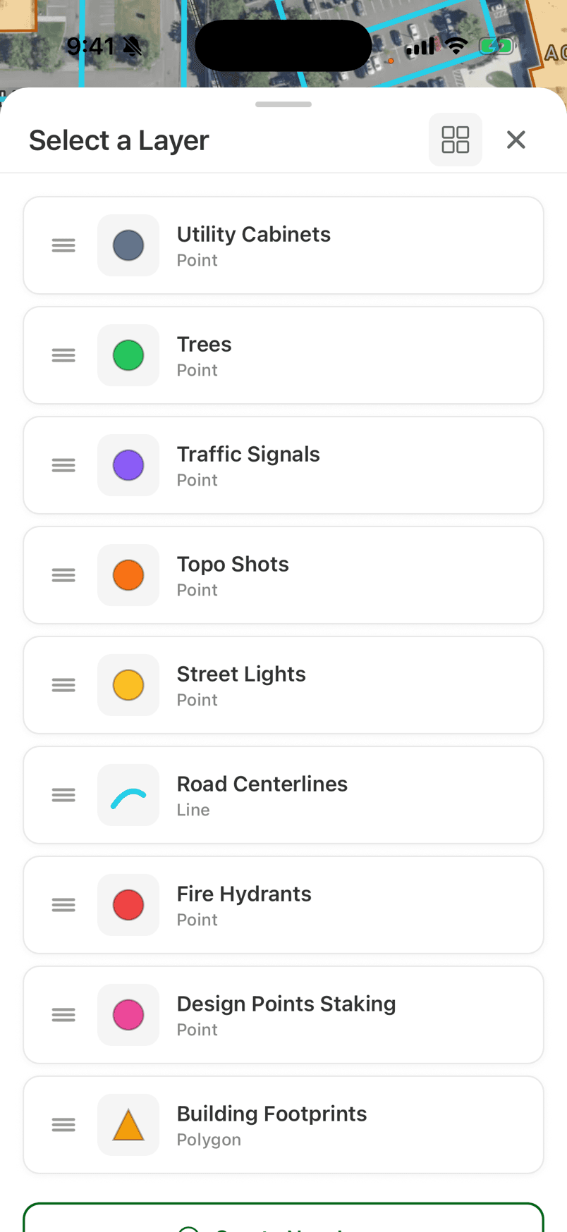
High-accuracy point, line, and polygon data collection
Tap, capture, done. Organized layers, rich attributes, and high-accuracy GNSS positions on every feature
- Mobile device internal GNSS or a high-accuracy Bluetooth GNSS receiver
- Points, Lines & Polygons
- Intelligent Attributes

TopoPremium
Auto-topographic data collection
Walk the site and the surface builds itself — points drop automatically at your chosen interval.
- Time-Based Capture
- Distance-Based Capture
- Eos Tilt Compensation

StakingPremium
Point staking with precision GNSS guidance
Load design points and navigate to each one with live distance, bearing, and cross-track guidance.
- Real-Time Navigation
- Precision Guidance
- Import CAD & Trimble

Static CapturePremium
RINEX data collection & OPUS submission for static post-processing
Log RINEX in the field and submit to OPUS from the phone — no desktop round-trip.
- Configurable Duration
- RINEX Data Collection
- OPUS Submission
Built to work where the signal doesn’t
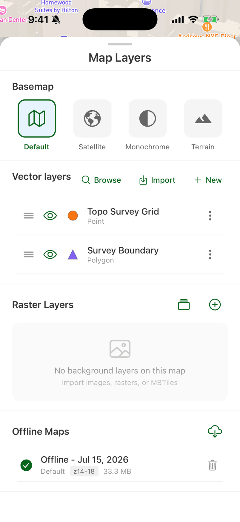
Collection, storage and maps all keep working with no connection — because the app was designed offline-first
On-device database
Every point, line, polygon and GNSS observation is stored on the mobile device the instant you capture it. Lose signal? Close the app? — your work is already saved.
Downloadable basemaps
Choose an area and download the map before you leave. Pan, zoom, collect and stake against real basemaps and 3D terrain with no connectivity
Crash-safe capture
If a session is interrupted, FastXY recovers your unrecorded data when you re-open the app — a closed app doesn't lose data
Positions keep logging with no connectivity
Extensive GNSS Metadata to prove the accuracy of your data
The entire coordinate stack, on-device
Fits the way you already work
Powerful Features, Free Forever
No account required. No artificial limits. Just download and start collecting data.
Organized, styled layers — pick one and start capturing.
Free vs Premium
FastXY is free to download with a genuinely useful core. Premium unlocks the professional workflows.
Collecting in three steps
Download the app
Free on iOS and Android — no account needed to start.
Set your positioning source
Internal GNSS or high-accuracy Bluetooth GNSS receiver
Pick a workflow & go
Choose Collect, Topo, Staking or Static and start capturing.
⌖ Get the app
Ready to get started?
Download FastXY free and start collecting high-accuracy GNSS data today.